sensor data

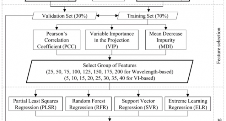
Quantifying Leaf Chlorophyll Concentration of Sorghum from Hyperspectral Data Using Derivative Calculus and Machine Learning

Bhadra, Sourav, Vasit Sagan, Maitiniyazi Maimaitijiang, Matthew Maimaitiyiming, Maria Newcomb, Nadia Shakoor, and Todd C. Mockler. "Quantifying leaf chlorophyll concentration of sorghum from hyperspectral data using derivative calculus and machine learning." Remote Sensing 12, no. 13 (2020): 2082. https://www.mdpi.com/2072-4292/12/13/2082

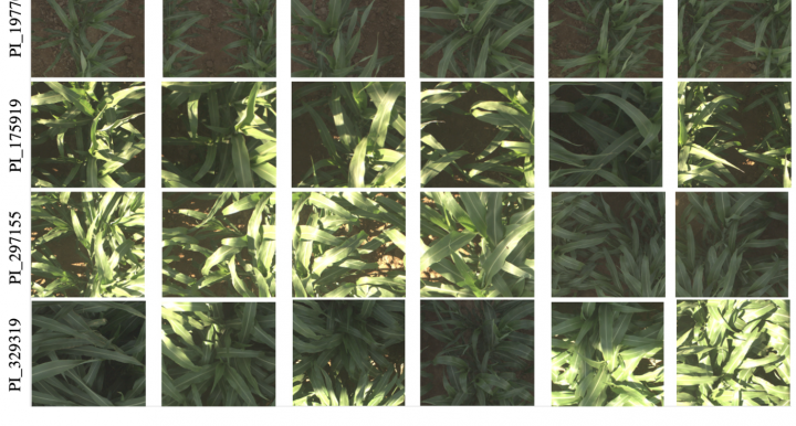
Multi-Resolution Outlier Pooling for Sorghum Classification

This paper introduces the Sorghum-100 dataset, a large dataset of RGB imagery captured by the TERRA-REF field scanner as well as a new and more powerful approach to identifying which plant variety (cultivar) is in a particular image.

The Sorghum-100 dataset was used in the Sorghum-100 Kaggle competition, which explains:

Chlorophyll fluorescence imaging captures photochemical efficiency of grain sorghum (Sorghum bicolor) in a field setting

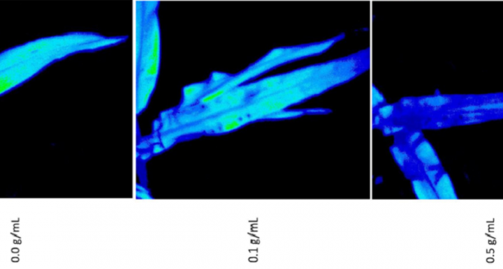
Herritt et al 2020 demonstrate the PSII camera's ability to capture PSII fluorescence by treating leaves with a chemical that inhibits photosynthesis (DMCU) and observing differences.   


Herritt, M.T., Pauli, D., Mockler, T.C. et al. Chlorophyll fluorescence imaging captures photochemical efficiency of grain sorghum (Sorghum bicolor) in a field setting. Plant Methods 16, 109 (2020). https://doi.org/10.1186/s13007-020-00650-0

Data-Driven Artificial Intelligence for Calibration of Hyperspectral Big Data

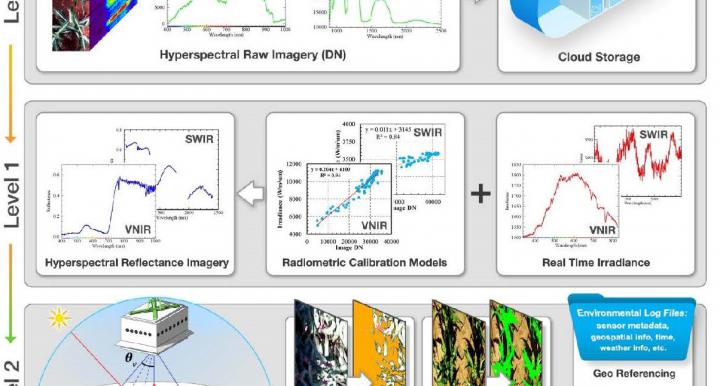
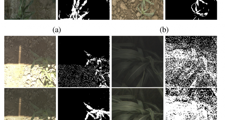
This paper describes the pipeline used to produce calibrated hyperspectral images from the two hyperspectral cameras deployed under field conditions. The pipeline implements radiometric calibration, reflectance calculation, bidirectional reflectance distribution function (BRDF) correction, soil and shadow masking, and image quality assessment.  This was a true tour de force!

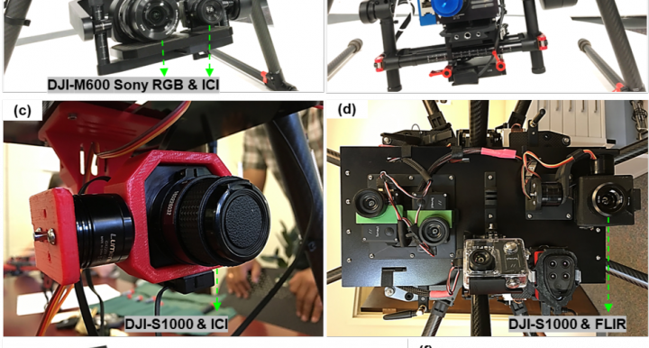
UAV-Based high resolution thermal imaging for vegetation monitoring and plant phenotyping using ICI 8640 P, FLIR Vue Pro R 640 and thermoMap Cameras

The growing popularity of Unmanned Aerial Vehicles (UAVs) in recent years, along with decreased cost and more accessibility of both UAVs and thermal imaging sensors, has led to the widespread usage of this technology, especially for precision agriculture and plant phenotyping. There are several thermal camera systems in the market becoming more available at a low cost. However, their efficacy and accuracy in various applications has not been tested.

TERRA-REF Data Processing Infrastructure

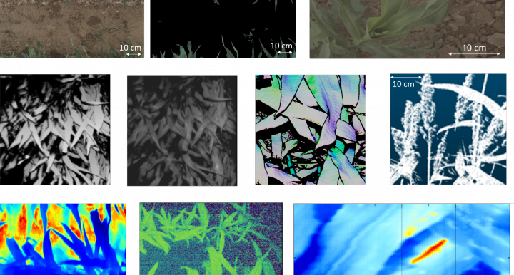
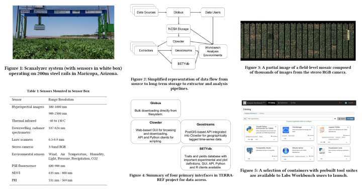
The Transportation Energy Resources from Renewable Agriculture Phenotyping Reference Platform (TERRA-REF) provides a data and computation pipeline responsible for collecting, transferring, processing and distributing large volumes of crop sensing and genomic data from genetically informative germplasm sets. The primary source of these data is a field scanner system built over an experimental field at the University of Arizona Maricopa Agricultural Center.

Subscribe to RSS - sensor data